

MARA
Improved mobility solutions for touristic remote regions
Many rural areas lack good mobility services, which hampers their economic development. Introducing innovative mobility solutions other than motorised private transport require relevant competences among the public authorities and a better overview of the actual mobility needs. Confronting the mobility demand of residents and tourists with the current mobility offers, and increasing the capacity of transport actors could be a response to the challenge.
Real-life testing
MARA brought together transport actors from the whole Baltic Sea region, including non-EU states - Norway and Russia. The project tested the practical use of e-bike and e-cargo bike sharing in Norway and Latvia, which especially during seasonal peaks can be an interesting mobility alternative for tourists. In Germany, the project improved a call-a-bus system by providing real-time information on highly dynamic connections. In Russia, MARA focused on the development of waterways as an alternative to road transport. Besides, MARA improved the governance framework by helping public authorities to integrate new mobility concepts into their spatial and mobility plans
details
-
Project typeRegular project
-
ImplementationJanuary 2019 - December 2021
-
Go to
-
StatusCompleted
-
Contribution to EUSBSR

Tags
(click to view similar projects)Budgets
in numbers
-
2.37MillionTotal
-
1.53MillionErdf
-
0.16MillionEni + Russia
-
0.13MillionNorway
Achievements
The project MARA brought together 12 project partners from Germany, Estonia, Latvia, Finland, Lithuania, Norway, Poland, Sweden, and Russia. Besides, 13 associated organisations got support by applying IT tools to analyse the gaps between real mobility demand and available mobility offers in remote touristic areas of the Baltic Sea region.
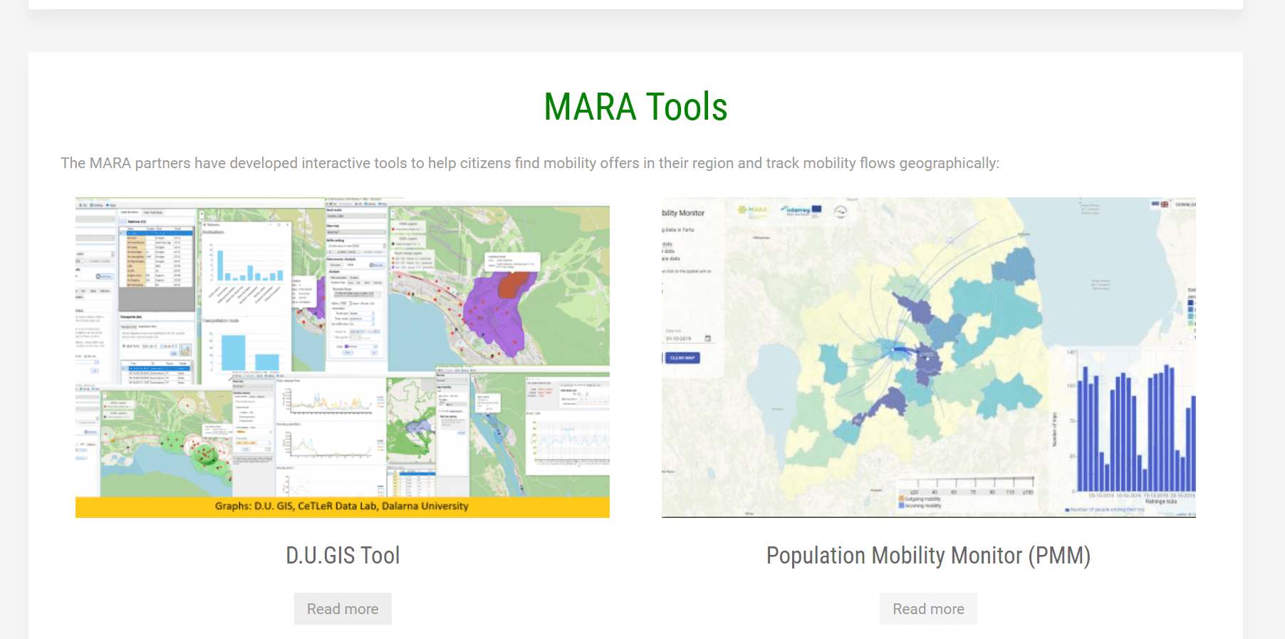
MARA enhanced the institutional capacity of public authorities responsible for mobility and spatial planning. The partner regions developed their own involvement strategy with a focus on target groups, the level of involvement and by what means (tools) the target groups should be involved. Public authorities got access to digital tools that helped them plan their mobility offers and track mobility flows geographically. Thus, one of the tools the Population Mobility Monitor (PMM) allowed to evaluate the real mobility demand, while another interactive D.U.GIS tool helped access and visualise accessibility gaps. Thanks to PTM tool (the Public Transport vs Mobility Tool), the authorities could benchmark mobility offers and mobility demand of the entire population.
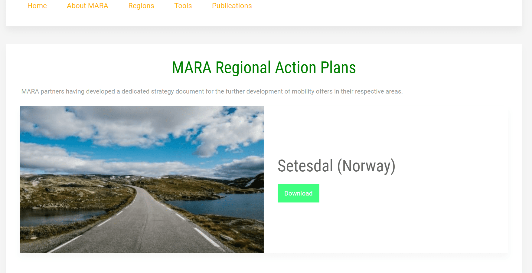
In addition, MARA enabled partner regions develop new tailor-made mobility offers for residents and tourists. Thus, the project helped establish new water routes on the Onega lake to increase the accessibility of the Zaonezhye region (Russia). Another example is a pilot in Setesdal (Norway) where an e-bike sharing system with 30 e-bikes has been procured and tested.
Besides, MARA helped transport actors increase their capacity in mobility and spatial planning, and how to use less financial resources. The project identified autonomous vehicles as tomorrow’s answer to providing cost-effective on-demand transport offers in remote regions
Outputs
Mobility mapping tools
Regional action plan for improved mobility
Project Stories
-
15.10.2020
Interview: “Interreg shows people what European Unity can really accomplish”
Niklas Nienaß is an energetic young politician from the Baltic Sea region. He is a German member of the European Parliament who was elected in Mecklenburg-Vorpommern, a region that is represented in 32 projects with 25 partners in the current Interreg Baltic Sea Region Programme. On the occasion of Interreg celebrating its 30th anniversary, we asked Niklas about his view on the future of Interreg cooperation.Read full story
Partners
Ministry of Energy, Infrastructure and Digitalization Mecklenburg-Vorpommern
- TownSchwerin
- RegionSchwerin, Kreisfreie Stadt
- CountryGermany
- RepresentativeHolger Janßen
- Phone
- E-Mail
- Web
Bialystok University of Technology
- TownBiałystok
- RegionBiałostocki
- CountryPoland
- RepresentativeElżbieta Szymańska
- Phone
- E-Mail
- Web
Vidzeme Planning Region
- TownCesis
- RegionVidzeme
- CountryLatvia
- RepresentativeAndžejs Stepančuks
- Phone
- E-Mail
- Web
Setesdal Regional Council
- TownValle
- RegionAust-Agder
- CountryNorway
- RepresentativeRita Hansen
- Phone
- E-Mail
- Web
Vilnius Gediminas Technical University
- TownVilnius
- RegionVilniaus apskritis
- CountryLithuania
- RepresentativeLaima Greičiūnė
- Phone
- E-Mail
- Web
Swedish Transport Administration
- TownBorlänge
- RegionDalarnas län
- CountrySweden
- RepresentativeMalcolm Lundgren
- Phone
- E-Mail
- Web
Petrozavodsk City Administration
- TownPetrozavodsk
- RegionRepublic of Karelia
- CountryRussian Federation
- RepresentativeNatalya Lavrushina
- Phone
- E-Mail
- Web
Hajnówka District
- TownHajnówka
- RegionŁomżyński
- CountryPoland
- RepresentativeBarbara Budnik
- Phone
- E-Mail
- Web
Dalarna University
- TownFalun
- RegionDalarnas län
- CountrySweden
- RepresentativeTobias Heldt
- Phone
- E-Mail
- Web
Tourist Information Center of the Republic of Karelia
- TownPetrozavodsk
- RegionRepublic of Karelia
- CountryRussian Federation
- RepresentativeIrina Spazheva
- Phone
- E-Mail
- Web
Finnish Environment Institute
- TownHelsinki
- RegionHelsinki-Uusimaa
- CountryFinland
- RepresentativeKari Oinonen
- Phone
- E-Mail
- Web
University of Tartu
- TownTartu
- RegionLõuna-Eesti
- CountryEstonia
- RepresentativeAge Poom
- Phone
- E-Mail
- Web
-
Project managerCarsten BeyerMinistry of Energy, Infrastructure and Digitalization Mecklenburg-Vorpommern
-
Legal representativeChristian DahlkeMinistry of Energy, Infrastructure and Digitalization Mecklenburg-Vorpommern
-
Financial managerMarkus WoelckMinistry of Energy, Infrastructure and Digitalization Mecklenburg-Vorpommern
-
Communication managerSusanne Altvaters.Pro sustainable projects GmbH