

Baltic LINes
Complex spatial planning
Planning the national sea area is a complex task where the different sectoral interests need to be carefully weighed against each other, conflicts have to be solved and planning solutions need to be found. At the Baltic Sea, there has been a growing competition among shipping and energy sectors to use the available scarce space and resources: shipping corridors collide with fixed installations, such as wind farms and pipelines.
Cooperate to plan better
A lack of coordinated maritime spatial planning decreases transnational connectivity and puts the natural Baltic Sea ecosystem at risk. It also leaves blue growth opportunities in the sectors of e.g. maritime transportation and coastal tourism untapped.
Although maritime spatial planning is a national competence, the EU Maritime Spatial Planning Directive from 2014 obliges the Member States to ensure that their national spatial plans are coherent across the sea-basins, which means that shipping routes, energy infrastructure and the ecosystem considerations should be coordinated.
However, there is insufficient cooperation among maritime spatial planners and authorities as well as industry in the countries around the Baltic Sea. There is no pan-Baltic spatial data infrastructure either, which would combine information from the neighbouring countries. Last but not least, there are no common criteria how to plan, which would help align the decisions taken on the energy infrastructure and shipping routes.
details
-
Project typeRegular project
-
ImplementationMarch 2016 - April 2019
-
Go to
-
StatusCompleted
-
Contribution to EUSBSRHorizontal Action Spatial Planning

Tags
(click to view similar projects)Budgets
in numbers
-
3.21MillionTotal
-
2.50MillionErdf
-
0.00MillionEni + Russia
-
0.00MillionNorway
Achievements
First database for spatial planners in the region
In order to overcome the challenge of inconsistent maritime spatial planning approaches and procedures in the countries around the Baltic Sea, Baltic LINes set up a system for exchanging maritime spatial plans; compiled requirements for planning and developed scenarios for future developments in the energy and shipping sectors.
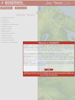
The project partners established BASEMAPS, the first in the Baltic Sea region online database, which provides a catalogue of up-to-date transnational Maritime Spatial Planning data. It displays already existing and planned infrastructures from neighbouring countries. In this way, BASEMAPS helps spatial planning authorities as well as the authorities responsible for energy or transport planning in countries around the Baltic Sea to make planning decisions.
Currently BASEMAPS are run by the Baltic Marine Environment Protection Commission – HELCOM. Whereas the procedures on updating the information are subject to the Maritime Spatial Planning (MSP) Working Group of the Baltic Marine Environment Protection Commission (HELCOM) & Vision and Strategies around the Baltic Sea organisation (VASAB).
The Working Group represents ministries, government agencies, HELCOM and VASAB observers and other organisations from the Baltic Sea region countries. It is forum that the Baltic LINes also addressed with the project’s recommendations on the energy, shipping and horizontal issues, for example on the need to involve the stakeholders from the energy sector such as transmission system operators, offshore wind farm developers or civil servants.
Preparing for future spatial challenges
Baltic LINes compiled spatial requirements for shipping and energy as well as future scenarios for 2030 and 2050, which were integrated into the Maritime Spatial Planning (MSP) Challenge. It is a virtual simulation game in which the planning authorities from all the Baltic Sea region countries can simulate different scenarios depending on the parametres they select. In this simulation, they develop plans for the future uses of sea space over a period of several decades, and observe the consequences of their decisions for energy, shipping and the marine environment. In this way, the MSP Challenge helps make better planning decisions to improve transnational coherence of shipping routes and energy corridors.
Linear infrastructures more coordinated
The project Baltic LINes used 2.50 EUR million from the European Union to increase the transnational coherence of shipping routes and energy corridors by enabling countries around the Baltic Sea to learn about each other’s plans. Now, the project’s results are in use in the Interreg Baltic Sea Region project platform, Capacity4MSP, which further increases collaboration among stakeholders, decision- and policy makers in maritime spatial planning.
Outputs
BASEMAPS - a map service to access Baltic Sea maritime spatial planning data
Practical guidelines for the designation of energy and transport infrastructure in the Baltic Sea
Project Stories
-
15.07.2019
Coherent planning of shipping and offshore energy across borders with Baltic LINes
The Baltic Sea experiences an increasing demand for coherent spatial planning in order to bring shipping routes and offshore renewable energy infrastructure together. Project partners from nine countries worked across borders to tackle the challenge of scarce space available and competing economic interests of the different sectors active in and around the Baltic Sea in the Interreg project Baltic LINes.Read full story
Partners
Federal Maritime and Hydrographic Agency
- TownHamburg
- RegionHamburg
- CountryGermany
- RepresentativeKai Trümpler
- Phone
- E-Mail
- Web
Baltic Marine Environment Protection Commission - Helsinki Commission (HELCOM)
- TownHelsinki
- RegionHelsinki-Uusimaa
- CountryFinland
- RepresentativeHermanni Backer
- Phone
- E-Mail
- Web
State Regional Development Agency, the Republic of Latvia (representing VASAB secretariat)
- TownRiga
- RegionRīga
- CountryLatvia
- RepresentativeTalis Linkaits
- Phone
- E-Mail
- Web
Ministry of Energy, Infrastructure and Digitalization Mecklenburg-Vorpommern
- TownSchwerin
- RegionSchwerin, Kreisfreie Stadt
- CountryGermany
- RepresentativeGabriele Hoffmann
- Phone
- E-Mail
- Web
Swedish Agency for Marine and Water Management (SwAM)
- TownGöteborg
- RegionVästra Götalands län
- CountrySweden
- RepresentativeThomas Johansson
- Phone
- E-Mail
- Web
Maritime Office in Gdynia (MOG)
- TownGdynia
- RegionTrójmiejski
- CountryPoland
- RepresentativeAndrzej Cieślak
- Phone
- E-Mail
- Web
Maritime Institute in Gdansk (MIG)
- TownGdańsk
- RegionGdański
- CountryPoland
- RepresentativeMagdalena Matczak
- Phone
- E-Mail
- Web
Coastal Research and Planning Institute (CORPI)
- TownKlaipeda
- RegionKlaipėdos apskritis
- CountryLithuania
- RepresentativeNerijus Blažauskas
- Phone
- E-Mail
- Web
Ministry of Environmental Protection and Regional Development
- TownRiga
- RegionRīga
- CountryLatvia
- RepresentativeKristīne Kedo
- Phone
- E-Mail
- Web
University of Tartu (UTARTU)
- TownTartu
- RegionLõuna-Eesti
- CountryEstonia
- RepresentativeRobert Aps
- Phone
- E-Mail
- Web
Aalborg University
- TownCopenhagen
- RegionByen København
- CountryDenmark
- RepresentativeHenning Sten Hansen
- Phone
- E-Mail
- Web
Finnish Environment Institute
- TownHelsinki
- RegionHelsinki-Uusimaa
- CountryFinland
- RepresentativeRiku Varjopuro
- Phone
- E-Mail
- Web
Finnish Transport Infrastructure Agency
- TownHelsinki
- RegionHelsinki-Uusimaa
- CountryFinland
- RepresentativeOlli Holm
- Phone
- E-Mail
- Web
Breda University of Applied Sciences
- TownBreda
- RegionWest-Noord-Brabant
- CountryNetherlands
- RepresentativeIgor Mayer
- Phone
- E-Mail
- Web
-
Project managerDominic PlugFederal maritime and Hydrographic Agency (BSH)
-
Legal representativeKai TrümplerFederal Maritime and Hydrographic Agency
-
Financial managerDominic PlugFederal maritime and Hydrographic Agency (BSH)
-
Communication managerDominic PlugFederal maritime and Hydrographic Agency (BSH)